
Enterprise GIS Solution

Turn fragmented spatial data into a connected operational system

GIS Pro establishes a managed enterprise GIS environment that connects spatial data, field workflows, business systems, web maps, dashboards and reporting—giving teams reliable access to the information they need to work and make decisions.
Managed Spatial Data
Bring important spatial datasets into a structured environment with clear standards, responsibilities and maintenance processes.
Connected Field and Office Workflows
Allow information to move between field teams, GIS professionals, operational systems and office users without repeated copying or manual re-entry.
Accessible Operational Information
Give different teams secure access to relevant maps, dashboards and reports without requiring every user to become a GIS specialist.
The Problem

When spatial information grows faster than the systems around it

Organisations rarely set out to create a fragmented GIS environment.
It usually develops gradually.

New datasets are downloaded for individual projects. Shapefiles and spreadsheets are saved in SharePoint folders or network drives. Field teams introduce separate collection tools. Different departments maintain their own versions of assets, constraints, properties, environmental records or operational boundaries.

Specialist business systems may contain valuable location-based information, but that information remains isolated from the wider GIS environment.

Over time, staff begin asking familiar questions:

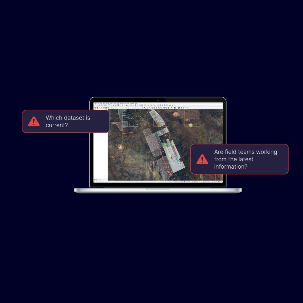
  • Which version of this dataset is current?
  • Who is responsible for maintaining it?
  • Are field teams and office staff working from the same information?
  • Why does the GIS not match the asset, geology or operational system?
  • Can management access the information without requesting another map?
  • Can the figures in a dashboard or report be traced back to dependable source data?

When answers depend on searching folders, comparing spreadsheets or asking the one person who understands the system, GIS becomes a bottleneck rather than a shared organisational capability.

The consequences extend beyond the GIS team:

  • staff lose time locating and checking information
  • duplicated datasets create inconsistencies and rework
  • field updates are manually transferred into office systems
  • maps and reports become outdated between production cycles
  • information remains locked inside specialist applications
  • reporting requires repeated reconciliation
  • decisions are made without a complete or current spatial picture
  • the organisation becomes dependent on a small number of knowledgeable individuals

The problem is not simply that the organisation needs another map, application or software licence.

It needs a dependable spatial operating environment.

How it works

A staged approach built around your organisation

GIS Pro establishes a managed enterprise GIS environment that connects spatial data, field workflows, business systems, web maps, dashboards and reporting—giving teams reliable access to the information they need to work and make decisions.
1

Understand the current environment

We meet with your key stakeholders to understand how you currently use spatial data, where it lives, and what is not working. This includes reviewing existing systems, data sources, and regulatory or reporting requirements.

2

Design the spatial foundation

Based on your needs, we design an enterprise GIS architecture that brings your priority datasets, web maps, field apps, and dashboards together. We focus on simple user journeys so staff can quickly find and use the information they need.

3

Implement, connect and 
improve the data

We configure the platform, implement web maps, dashboards, and mobile projects, and migrate or clean existing datasets as required. Where appropriate, we integrate GIS with your other systems such as CRM or third party systems.

4

Make information useful for 
each audience

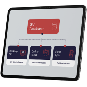
Different users need different levels of access.

GIS professionals may require advanced desktop tools and direct database access. Field teams need clear mobile forms and offline workflows. Operational staff may need a focused web map. Management may require dashboards and exception reporting.

We design each interface around the decisions and tasks of its users instead of exposing everyone to the full technical complexity of the GIS.

5

Support adoption and 
continued improvement

An enterprise GIS environment is not finished at launch.

We train users according to their role, document key processes and provide ongoing support as datasets, workflows and organisational requirements evolve.

This helps the system remain useful after the initial implementation rather than becoming another platform that gradually falls out of use.

Key capabilities

What the platform delivers

Get In Touch

GIS Pro centralises priority spatial datasets within a structured environment supported by clear data models, naming conventions, maintenance processes and responsibilities.

This reduces uncontrolled duplication and helps users understand:

  • which dataset is authoritative
  • who maintains it
  • when it was updated
  • how it should be used
  • which reports, maps or systems depend on it

The outcome is not merely more centralised storage. It is greater confidence in the information used across the organisation.

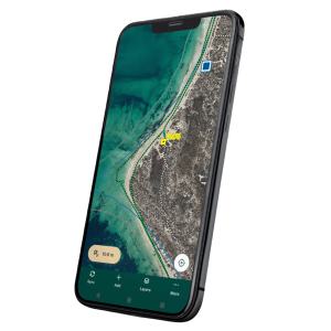
We configure field data collection workflows that connect with the wider GIS environment.

Depending on the use case, field teams can capture:

  • inspections
  • photographs
  • asset condition
  • environmental observations
  • exploration or operational activity
  • maintenance progress
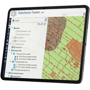
  • disturbance and rehabilitation
  • project or works status

Structured forms, validation and synchronisation reduce transcription and allow office users to access field updates without waiting for separate spreadsheets or manual data transfer.

Enterprise GIS should complement specialist business systems rather than create another isolated data store.

GIS Pro can connect spatial information with relevant operational systems, such as:

  • geology and drilling databases
  • laboratory data
  • asset-management systems
  • document and permit registers
  • customer or property systems
  • project and works information
  • authoritative government datasets

The aim is to make location-based information visible in context while allowing specialist source systems to continue performing their core role.

Many organisations depend on government, regulatory or third-party datasets that change over time.

GIS Pro can automate the retrieval, validation and loading of authoritative data according to the source’s publication schedule and the organisation’s operational requirements.

Updates may run daily, weekly or monthly depending on the dataset.

This reduces repetitive preparation and gives users more consistent access to current contextual information.

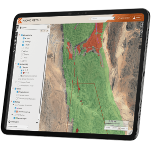
We configure browser-based maps around specific audiences and workflows.

Examples include:

  • operational maps for exploration and environmental teams
  • asset and infrastructure maps
  • planning and constraints maps
  • internal project portals
  • management overviews
  • selected public-facing maps

Users see the layers, tools, searches and print outputs relevant to their role without being exposed to unnecessary GIS complexity.

Once the underlying data and processes are dependable, GIS Pro can create dashboards and reporting views that present key spatial and operational information clearly.

These may support:

  • activity and project monitoring
  • compliance and exception review
  • field-work progress
  • disturbance and rehabilitation
  • asset condition
  • laboratory or sampling QA/QC
  • planning and service analysis
  • management reporting

Dashboards draw their value from the quality of the data and processes beneath them. They are not treated as a substitute for data governance.

GIS Pro can automate repeatable processes such as:

  • data synchronisation
  • data validation and transformation
  • standardised calculations
  • map and report production
  • spatial compliance checks
  • system-to-system data update
  • scheduled reporting outputs

This reduces repeated manual handling and makes important workflows more consistent and traceable.

The environment can be configured with appropriate user roles, permissions and access controls so teams can view or maintain the information relevant to their responsibilities.

Governance is built into the solution through:

  • clear ownership of important datasets
  • defined editing responsibilities
  • controlled access
  • documented workflows
  • repeatable backup and recovery arrangements
  • traceable changes where required
  • informed by relevant ISO/IEC 27001 principles.

The exact controls are designed around the organisation’s operational and security requirements.

A well-designed enterprise GIS environment provides a foundation that can be extended over time.

New workflows, integrations, field projects, dashboards or user groups can be introduced without rebuilding the entire environment for every requirement.

GIS Pro remains available to support, improve and extend the system as the organisation changes.

Business Value

What this delivers for your organisation

Greater confidence in the spatial information used for operational and strategic decisions
A governed environment instead of uncontrolled files spread across folders and individual systems
Better connection between field teams, GIS specialists, operational staff and management
Less repeated downloading, copying and manual re-entry
More consistent datasets, maps, dashboards and reporting outputs
Relevant spatial information made accessible beyond the specialist GIS team
Earlier visibility of operational issues and exceptions
Reduced reliance on a small number of individuals who know where everything is stored
Greater ability to integrate spatial information with business and operational systems
A scalable open-source foundation with less dependence on per-user proprietary licensing
Greater control over core spatial data and how it is used
A system that can evolve as organisational needs change
Get In Touch