

Case Studies

Collaborative Web Mapping Platform

Co-Designing a Regional Cycling Network Across 32 Councils

Client
Department of Transport (WA)
Location
Perth & Peel regions, Western Australia
Sector
State Government Transport & Strategic Planning
The Challenge

32 councils. One network.

Too many files. The Department of Transport needed to coordinate a single Long Term Cycling Network across 32 local governments, each with different priorities and consultation processes.

Planning relied on emails, meetings, and static PDF maps. Every update triggered another round of files and manual reconciliation.

This made it difficult to:

  • Maintain one trusted version of the network
  • Resolve cross-boundary issues between LGAs
  • Track progress across 32 stakeholders
  • Scale consultation without heavy staff overhead
The Solution

One shared online mapping workspace.

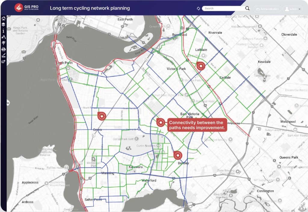
GIS Pro deployed a collaborative web mapping platform that replaced file-based consultation with live, shared maps.

Each council and DoT worked in the same spatial environment, contributing, reviewing, and refining cycling routes in real time. All inputs were automatically consolidated into a single regional Long Term Cycling Network.

How it works

1

Council Web Maps

Draw & edit cycling routes in-browser

2

Live Collaboration

Comments, review, and change tracking

3

Central Network View

Automatic consolidation across LGAs

4

DoT Oversight

Progress tracking and conflict resolution

The Outcome

Faster collaboration. Clearer decisions. One source of truth.


Web Maps for 32 Local Governments

Simple, browser-based tools for drawing and refining cycling routes.

Built-In Collaboration

Commenting and change tracking at the route level.

Progress Visibility

Clear insight into completion status, gaps, and follow-ups.

Role-Based Views

Councils focus on local areas. DoT maintains a live regional view.

Automatic Network Consolidation

All council inputs flow into one unified LTCN dataset.

Client testimonial

“I’ve worked with GIS Pro for the past two years on a significant State project, requiring the development of a range of online mapping portals to capture stakeholder inputs. GIS Pro have always been responsive in finding solutions to the technical challenges of the project and are real team players.”

Matt Root
Long Term Cycling Network Coordinator - Department of Transport (WA)