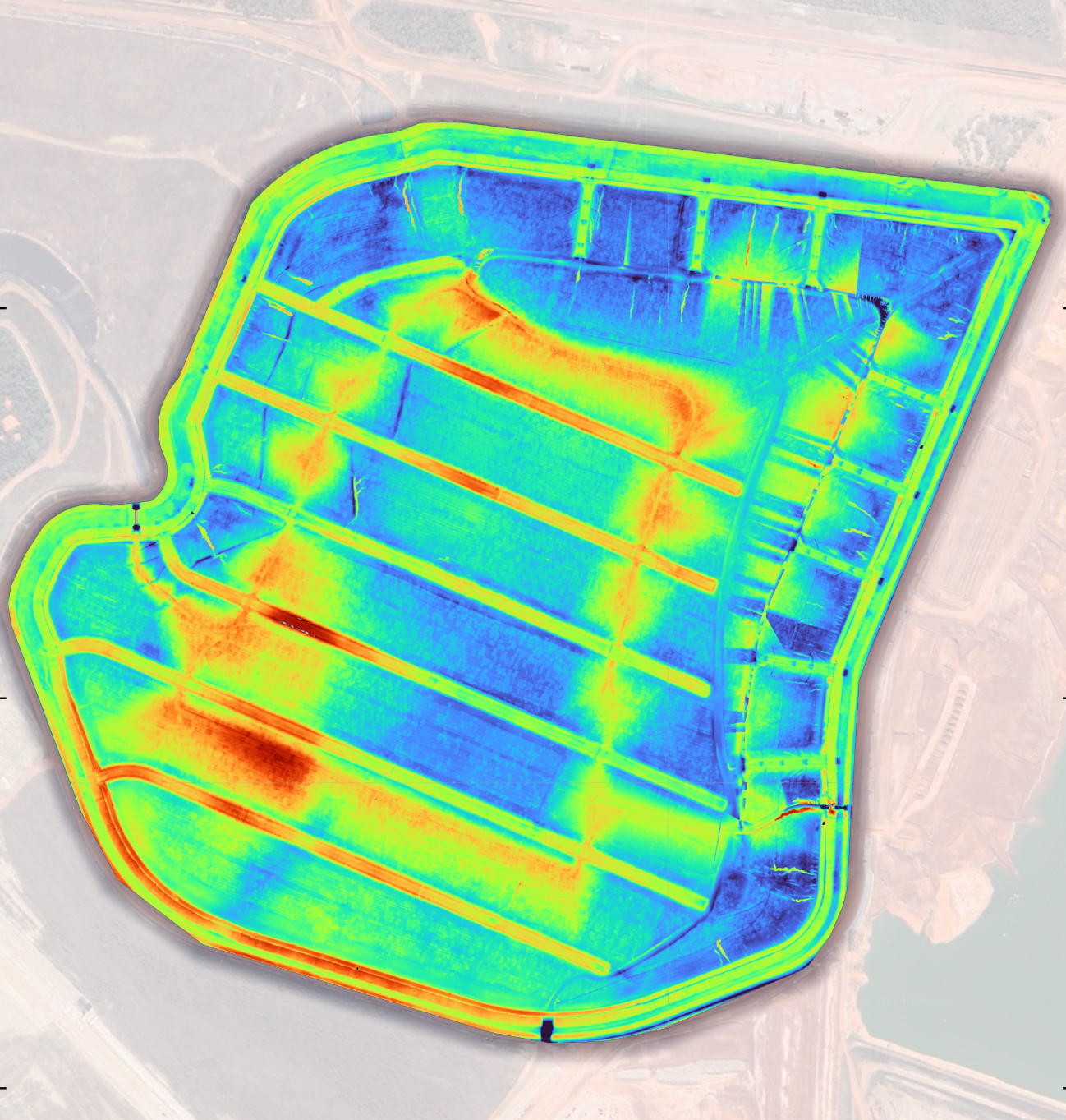
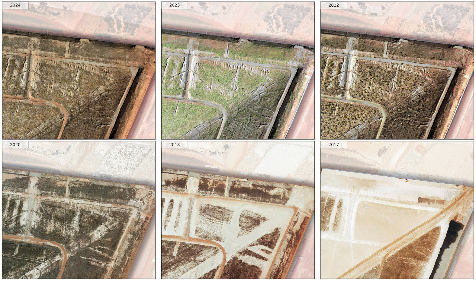
TerraTech Consulting partnered with GIS Pro to analyse and quantify erosion on a tailing facility. The goal was to assess soil loss over time and ensure it remained within safety thresholds.
Using high-resolution LiDAR survey data from 2022, 2023, and 2024, GIS Pro compared changes against a 2018 baseline survey. This approach allowed us to systematically identify erosion features and estimate the volume of soil lost at each stage.
Our analysis provided accurate and repeatable results, helping TerraTech track erosion trends over multiple years. Field measurements conducted by TerraTech confirmed that the erosion estimates aligned with on-the-ground observations.
Reliable GIS Support Throughout the Project
GIS Pro provided continuous GIS support during the project ensuring that TerraTech had access to accurate geospatial analysis and up-to-date data for erosion monitoring.
By leveraging high-resolution LiDAR data and GIS analysis, GIS Pro helped TerraTech gain a clear understanding of erosion patterns and ensure the site remained within safety limits. Our GIS-driven approach enabled TerraTech to proactively manage erosion risks on the tailing facility.
Need to leverage GIS to analyse your spatial data? We specialise in accurate geospatial analysis to support environmental monitoring, infrastructure planning, and decision-making. Get in touch to see how we can help with your project.